Property Details
Property Description
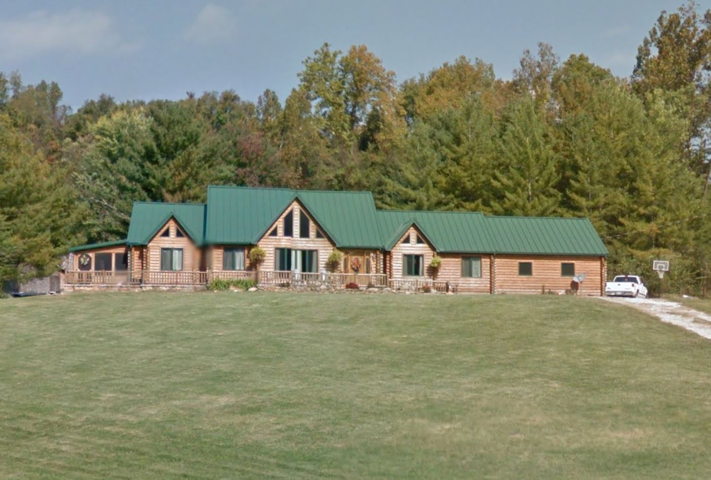
Subject property is a 3 BR / 1.50 BA Single Family Home w/ No Garage, containing 2,642 Sq Ft +/- built in 2008. Parcel number: 29-013-1700.000, 29-013-1800.000. Minimum Bid $ 206,733.33 . All auction end Wednesdays at 1PM. 5% buyer's premium will apply over and above high bid. Please read terms and conditions for details related to purchasing foreclosure property. Interior showings are not available. To earn a commission, Buyer referrals must be made to Auctioneer before prospective buyers make any contact with Auctioneer or register for bidding. Use link: https://www.gryphonusa.com/broker-acknowledgement-form/ This is a foreclosure situation. Property being offered by Private Selling Officer per the authorities granted in Ohio Revised Code 2329.152 . Information available has come from public sources and is believed to be accurate but is not guaranteed. Buyers should conduct their own due diligence before bidding. List Agent has not physically viewed the property. Due to the nature of the sale, interior inspections are not allowed. Cash sale only. The auction is subject to postponement and cancellation. No financing.
Legal Description
Situated in the Village of Coal Grove, County of Lawrence and State of Ohio, to-wit: Beginning at a point in the centerline of the right of way for State Route 243 at Station 28.00; thence North 16 deg. 53 min. East, passing a set iron pin in an old fence line at 27.30 feet, crossing the North edge of the aforesaid right of way at 40 feet to a set iron pin at a total distance of 320.83 feet; thence following an old fence line, South 79 deg. 00 min. East, 165.18 feet to a fence post corner to a tract of land owned by Clara Sites and shown as Tract 2 in Vol. 409, P. 459 of the Lawrence County Deed Records; thence following an old fence line, South 83 deg. 32 min. East, 106.22 feet to a set iron pin on the West edge of a 30 foot right of way; thence South 84 deg. 12 min. East, 38.66 feet to a set iron pin at the most Northeasterly corner of this tract and at the East edge of the 30 foot right of way; thence South 44 deg. 48 min. West, 104.77 feet to a set iron pin; thence South 16 deg. 40 min West, 258.26 feet to a point in the centerline of the right of way for State Route 243; thence along the chord of a curve to the right having a radius of 953.27 feet and a bearing of North 76 deg. 07 min. West, and a chord a distance of 259.31 feet to the point of beginning, and containing 2.00 acres. The above described tract is intended to be one and the same as the 2 1/6 acres and 1/20 of an acre tracts described in Tract 2, Vol. 409, P. 459, of the Lawrence County Deed Records. Reserving and Excepting, a 30 foot right of way across the aforesaid 2.00 acre tract, described as follows: Beginning at the most Southeasterly corner of the aforesaid 2.00 acre tract; thence North 16 deg. 40 min. East, 258.26 feet to a set iron pin; thence North 44 deg. 48 min. East, 104.77 feet to a set iron pin at the most Northeasterly corner of said 2.00 acre tract; thence North 84 deg. 12 min. West, 38.66 feet to a set iron pin; thence South 44 deg. 48 min. West, 104.77 feet to a set iron pin; thence South 16 deg. 40 min. West, 258.26 feet to a point in the center line of the right of way for State Route 243; thence South 76 deg. 07 min. East, 30.00 feet to the point of beginning.
Location
Foreclosure Details
Click the link to review the Conditions of Sale for this auction.
Conditions of SaleAuction By
